Welcome to Namibia
April 13, 2018
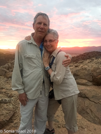
Namibia was my reason for coming to Africa. It was the top of my bucket list. I had heard about its beauty, and it was time to see it for myself. We had just spent two weeks in Cape Town, Johannesburg (Joburg), Botswana and Zambia (please see those posts), and now, finally, we were on our way to Namibia.
We sat in the airport in Joburg, waiting and waiting for the bus to take us to the plane. I started talking to a woman sitting next to me, Emelia. Emelia lives in Namibia and we spent some time chatting. Finally, the bus came to take us to the plane. Oon the bus we started talking with a woman standing next to us. She was from South Africa, but said she is so lucky to now live in Namibia. She and Emelia both said they know they will see me again as Namibia is a place you have to keep coming back to.
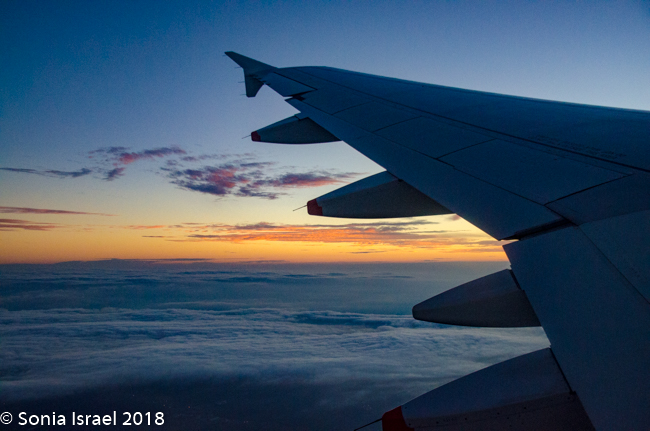
We boarded the Namibia Air plane and I could hardly contain my excitement. Adventure lay ahead. The air around me was filled with excitement. The sky 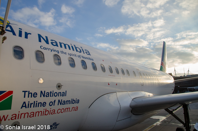 beckoned. The plane took off. I love that glorious feeling of traveling somewhere new. My heart was racing. My nerves were tingling. I was finally heading to Namibia.
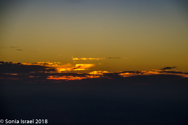
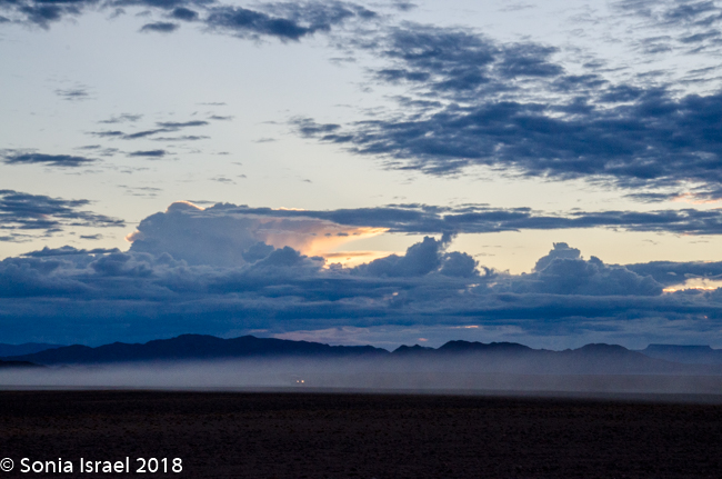
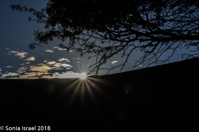
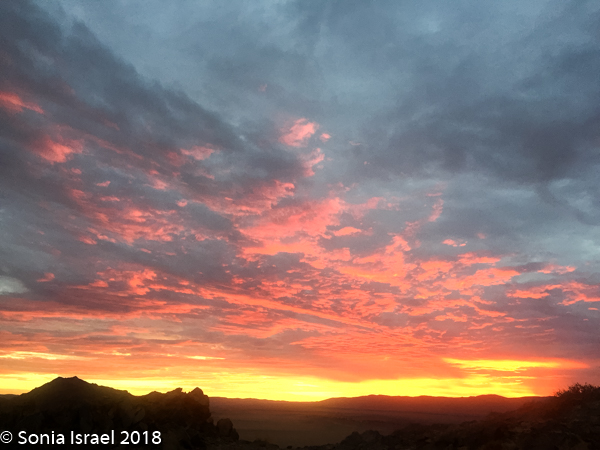
We took off just as the sun was setting over Joburg. The sky burst into flames looking as if it were on fire. The sun set. That fire sizzled out. But the fire in my soul had been ignited. And it will not be as easy to put out. I want to keep going and going and seeing more and more of the world. And I am. Namibia here I come.
We arrived at Hosea Kutako International Airport (WDH) in Windhoek 30 minutes early. It was dark as we climbed down the steps onto the tarmac. The walk to the terminal felt like it took over 5 minutes. We walked and we walked and we walked. We were met by a Piper and Heath representative (the tour company we used) who told us our driver was stuck in traffic, so we waited in the Wilderness Safari private lounge. When the driver, Raymond, arrived, it was another 5-minute walk to the car and then a 40 minute drive to our hotel in Windhoek.
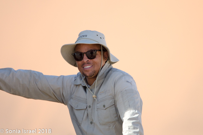
No one seemed to know when we would be picked up the next morning. Raymond said he would call but we never heard anything. We were tired, it was late and so, as has been our custom in Africa, we were asleep by 930. At 11:00 we were sound asleep and were awoken by a knocking on our glass door. Our guide had come looking for us. Charles. Charles would be spending the next week with us, and he became family, but at close to midnight, I had no idea what he was doing there. He came in and we all sat on the bed reviewing the plans. He told us that he had been calling and calling but the hotel was not answering. So he drove over to see us.
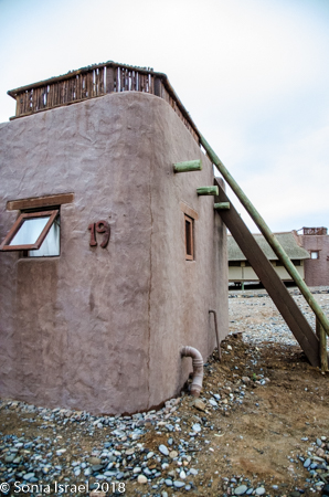
Galton House
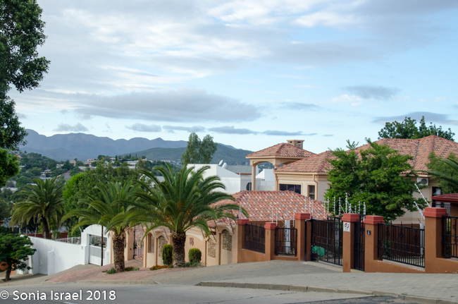
We were staying at the Galton House, which was once a home and was now converted for guests. It was in a residential area, the suburb of Eros, which made it totally inconvenient to walk around town which was a ten-minute drive away. It was a total disappointment after all the beautiful lodges we had been in, in the other parts of Africa. It had been described as “Windhoek’s newest accommodation establishment” and was named after the famous explorer Sir Francis Galton. “It has a relaxed but efficient style that creates a very welcoming atmosphere.” I did not find it particularly welcoming. It is true that there were beautiful black and white 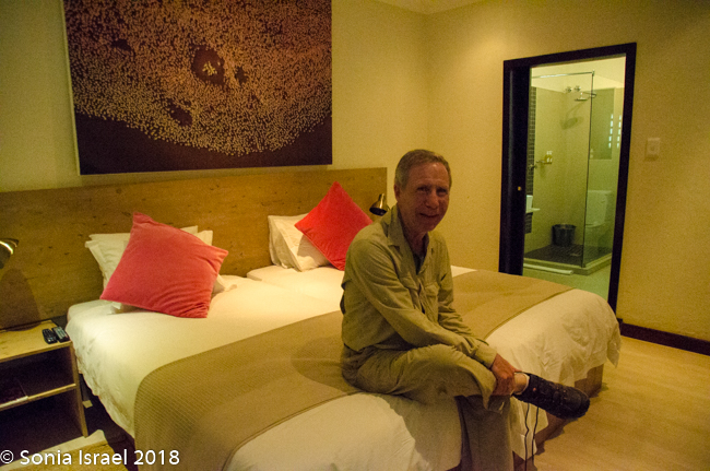 wildlife photography on the walls, and it was in fact minimalistic. So minimalistic as to be downright simple. The safe in the room was the size of a tissue box. The towels were like sandpaper. There was no closet but rather a small set of two shelves where you could hang a few clothes. The bathroom vanity was so small that I had to leave my bathroom items on shelf in bedroom. There was free internet, but the network was so weak that two people could not use it at same time. There were no tissues. But it was clean and we had arrived late and would be leaving early.
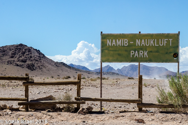
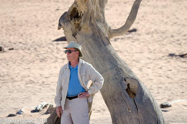
Charles met us for breakfast at 730 the next morning. Seems that I ate something that disagreed with me on Namibia Air, so I just ordered toast. It came brunt. That really said all about the Galton House. After breakfast, he pulled out a map and  showed us the route for that day. Our destination was Sossusvlei. But it would be about a five-hour drive. Charles made me write down the roads we would take. C26 to D1265 to D1261 to Spreetshoogte (our first official stop) to Solitaire (for lunch) to C19 past Sesriem to Kulala Desert Lodge. Sounds so simple. Read on.
The long drive “home”
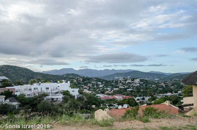
So it was time to leave. We did a quick drive through Windhoek, the capital of Namibia and then quickly left it behind.
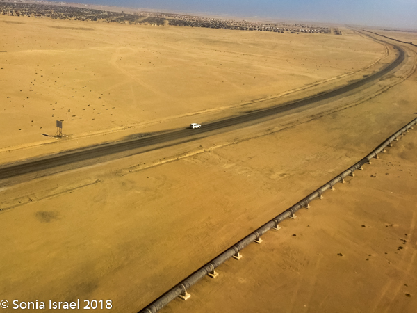
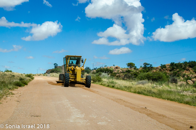
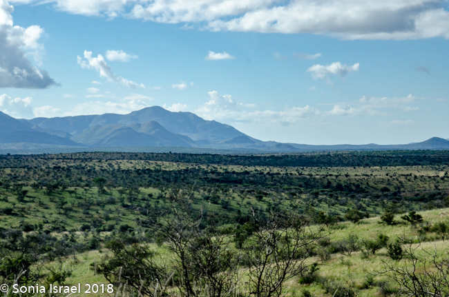
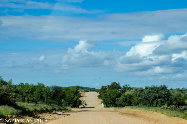
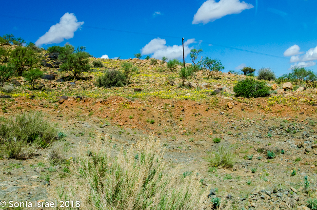
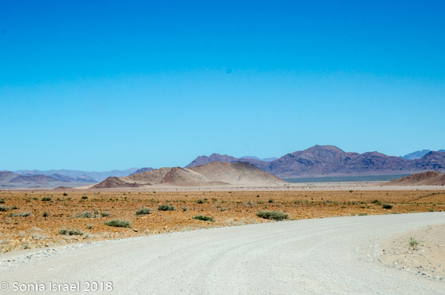
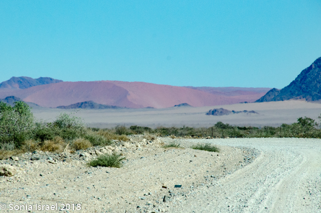
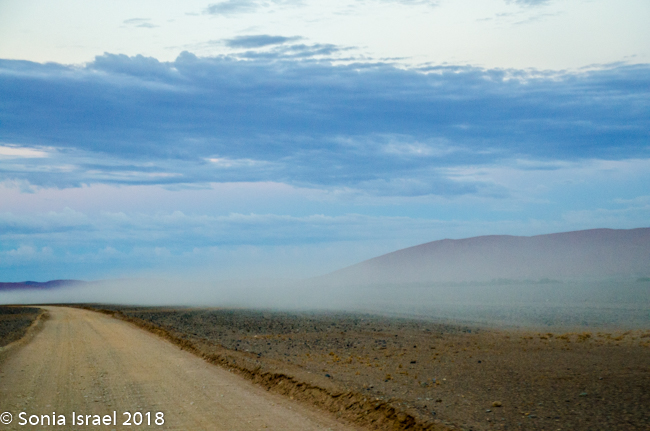
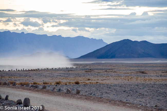
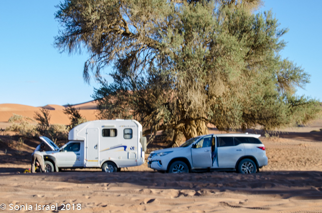
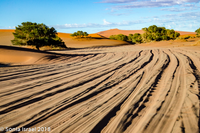
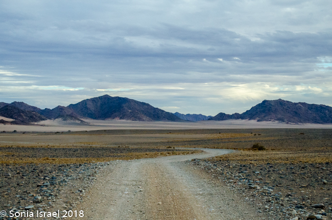
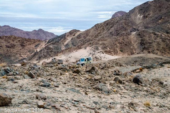
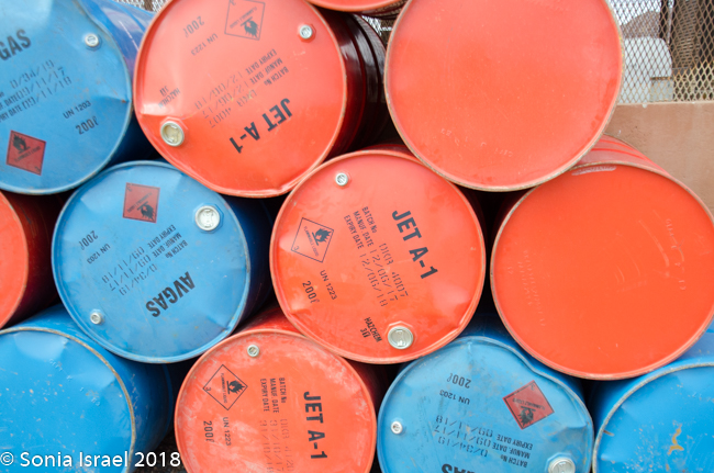
We were driving on one of the few paved roads in Namibia, straight out of town. The road quickly changed to gravel. Little did I know that unpaved roads were the norm here, even official roads with numbers. Gravel. Sand. Potholes. Washboard, corrugated roads. Every once in a while we would see a tractor trying to even out the road. Good thing we were in a Toyota Land Cruiser!
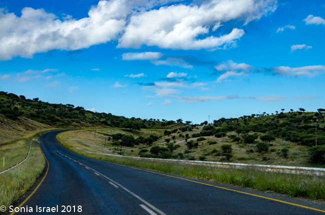
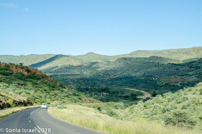
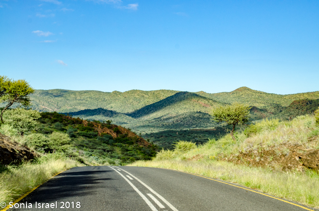
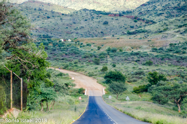
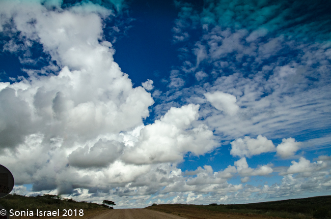
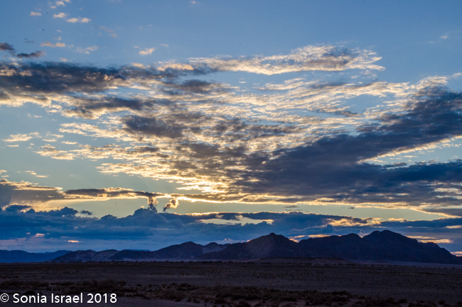
Although Namibia had been having a drought for the last seven years, there was recently lots of rain and that made the roads even more difficult to navigate. But it also made everything green. There were shades of green everywhere. The grass was a light green with dark green polka dot bushes. There were red tips on the green grass alongside white puffs of grass (these clumps of grass are called Bushman Long Grass, although it looks short because the animals keep eating it). The road was a red/brown. And the sky was a deep blue with billowing white clouds. It was a rainbow of colors which made for beautiful vistas.
Our first viewing of wildlife were a group of cannibalistic chacma baboons. They are  called cannibalistic because during a drought, when food is scarce, they eat their young. Luckily Namibia is in less of a drought now.
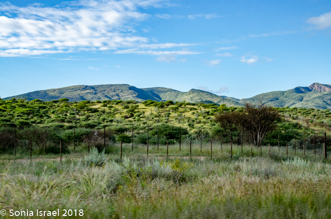
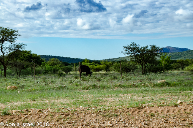
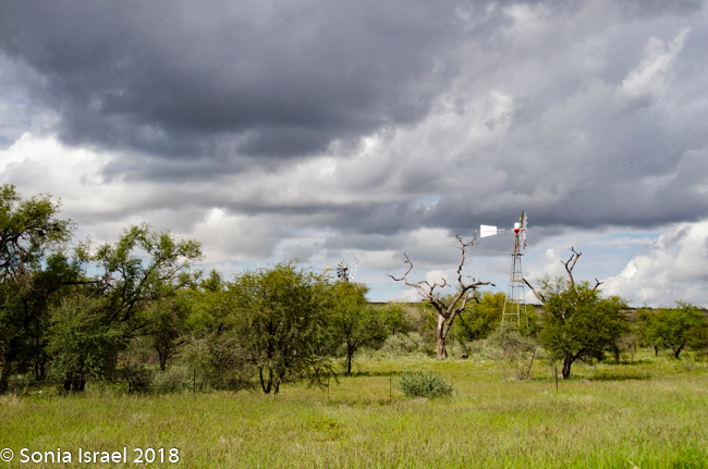
We passed lots of cattle farms as it was the German cattle farmers who displaced the locals and resettled the land here.
History of Namibia
Let’s get a brief bit of history for context. Namibia is officially the Republic of Namibia. It is bordered by the Atlantic Ocean on the west, Angola and Zambia on the north, Botswana on the east, and South Africa on the east and south. It is separated from Zimbabwe by the Zambezi River. The original inhabitants were the San (previously called the Bushmen), the Damara, the Nama and the Bantu (also known at Ovambo) peoples. In 1884, the German Empire established rule of most of the territory as a protectorate. German farmers came and took the best land, moving the locals further afield. It is this influence that is still seen in cities such as Windhoek (the capital) where the street names are in German and many of the locals speak German. In 1915, South African forces defeated the Germans and Namibia came under South African administration, including its laws of apartheid. After intermittent fighting, Namibia gained its independence in 1990. Charles told us that they still held on the Walvis Bay until 1994, so many Namibians consider 1994 as their year of independence.
The population of Namibia is about 2.5 million but because of the large, arid Namib Desert, Namibia is one of the least densely populated countries in the world. Its government is a democracy. It is considered one of the safest countries in all of Africa. Industries include agriculture, herding, tourism and mining (diamonds, uranium, gold, silver and base metals).
The Namib Desert, after which the country is named, is one of the oldest deserts in the world. The word Namib itself means “vast place” which absolutely describes this country correctly.
One of the most interesting things that Namibia has done, which I wish all African countries would do, is to set up communal wildlife conservancies. These give local communities rights to wildlife management and tourism. The conservancies stress the importance of local community control and any funds that the community receives through their conservancy must be distributed to the local community. There are several types of conservancies including traditional villages which display their traditions for tourists, thus conserving their cultural heritage; protecting forests, grazing areas and farms; and the most important, protecting wildlife. For example, is a farmer’s cow is killed by a desert lion or elephant, the conservancy pays him for his cow. No one is allowed to kill wildlife. In this way, the endangered species and others are protected.
Empty Roads
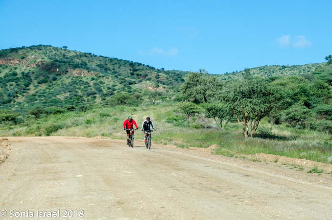
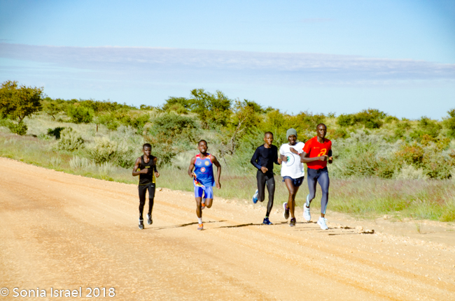
We kept driving and driving, hardly seeing another car. There were joggers and lots of bicyclists. Perhaps a bike race, or perhaps just people enjoying a sunny Saturday.
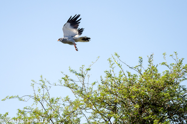
We were driving through the semi-desert, but suddenly, the landscape changed and the bushes were so dense that it looked like a large green carpet, with little yellow spots, the flower Cleome, also called whiskers. There were birds everywhere. We passed a pale chanting goshawk, a swallow tail bee eater and two leopard faced vultures sitting in a tree. Charles would ask us questions, which when we couldn’t answer, he would use as a jumping off point to teach us something. Did we know how to tell the difference between a vulture and an eagle when they are flying in the sky? Of course we didn’t. But we do now. Vultures have straight wings and eagles have bent wings.
-
- pale chanting goshawk
-
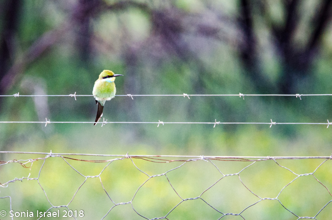
- a swallow tail bee eater
-
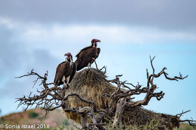
- leopard faced vultures
Tropic of Capricorn
As we were driving, out of the corner of my eye, I saw a sign that said Tropic of Capricorn. The Tropic of Capricorn, also called the Southern Tropic, is the southernmost latitude where the sun can be directly overhead. The northern 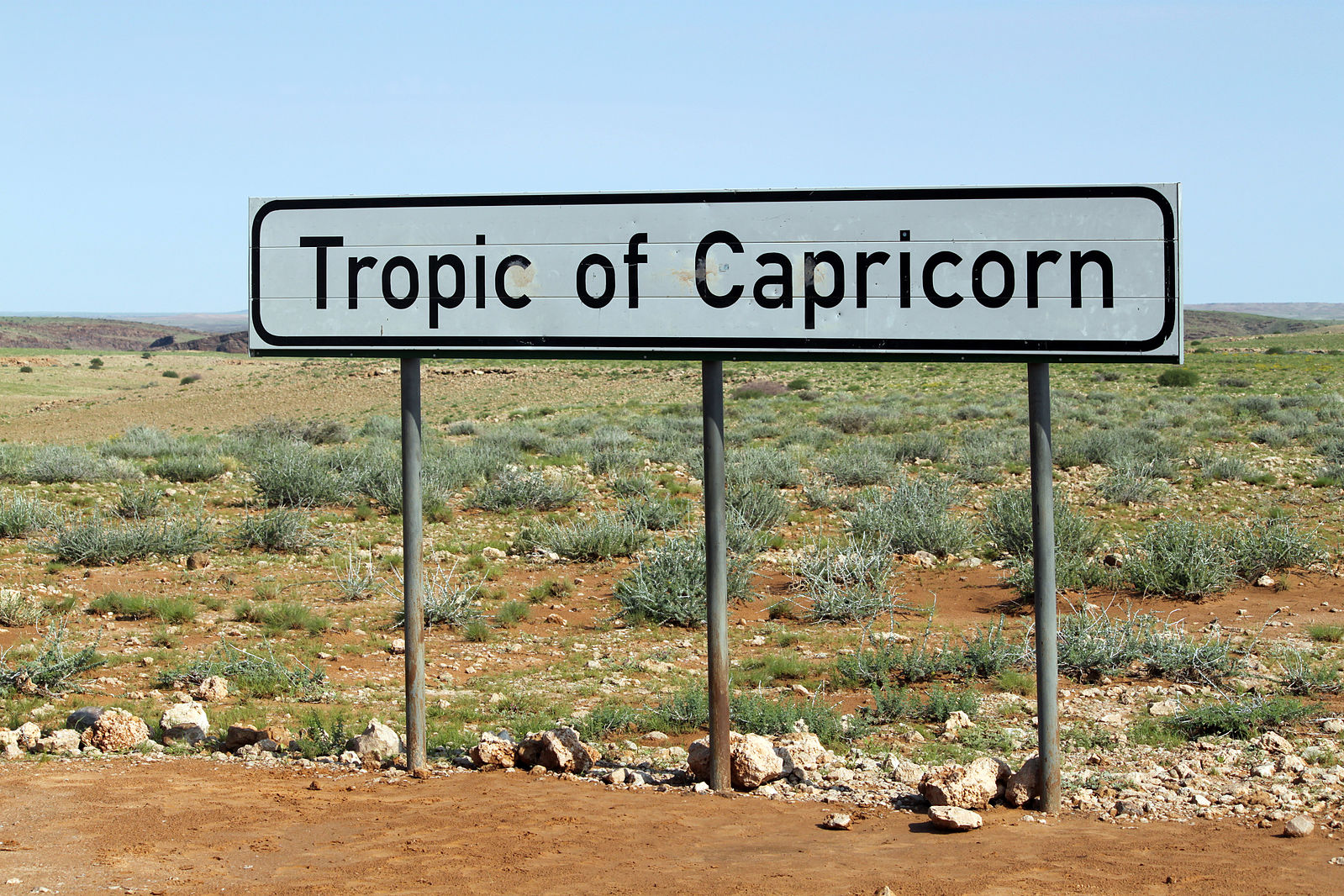 equivalent is the Tropic of Cancer. The Tropic of Capricorn is the dividing line between the southern temperate zone to the south and the tropics to the north. How cool it was to cross it!
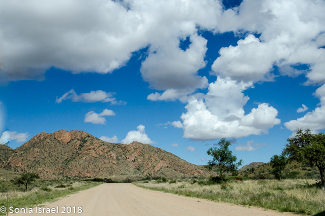
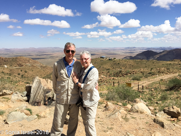
Spreetshoogte Pass
The drive continued. Our first “official” stop, other than stops to use the “bush toilet,” was a magnificent view point, Spreetshoogte Pass. This mountain pass connects the Namib Desert with the Khomas Highland. It is the highest point at 5839 feet above sea level and it is the steepest pass in Namibia, dropping 3300 feet within 2.5 miles of road. On the way down, I held Charles’s phone to do a video of the steep winding road.
But it is for the view at the top that everyone stops. It reminded me of the drive we make from San Diego to Palm Springs with purple mountains majesty. The panorama was breathtaking. Mountains full of minerals making them glow in every color. And the desert. Vast. Flat. Colorful. It was worth the stop, although that is easy for me to say as I wasn’t driving.
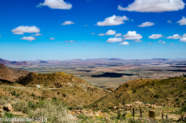

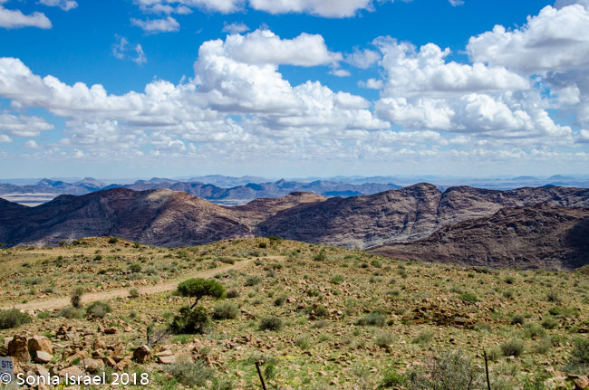
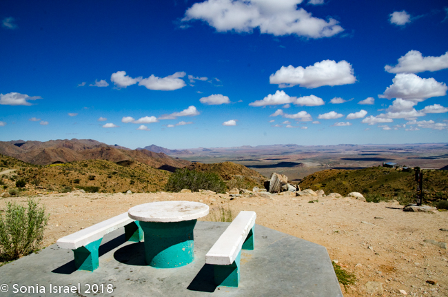
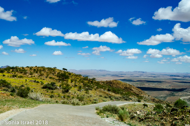
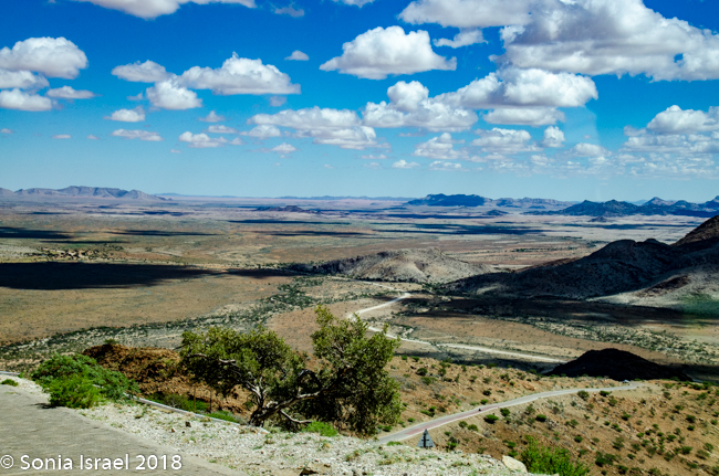

There were a few other people up there as well, and we would find ourselves running into them again and again in the next few days. Everyone who visits here pretty much has the same itinerary, plus or minus a bit here and there. And for those driving to Sossusvlei rather than flying, this was the place to stop.
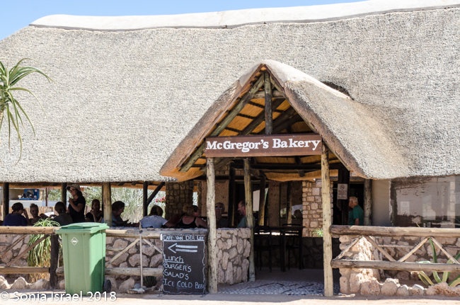
Solitaire
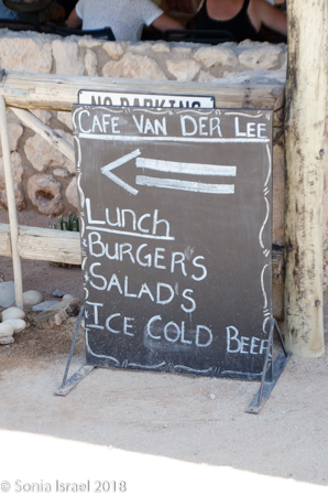
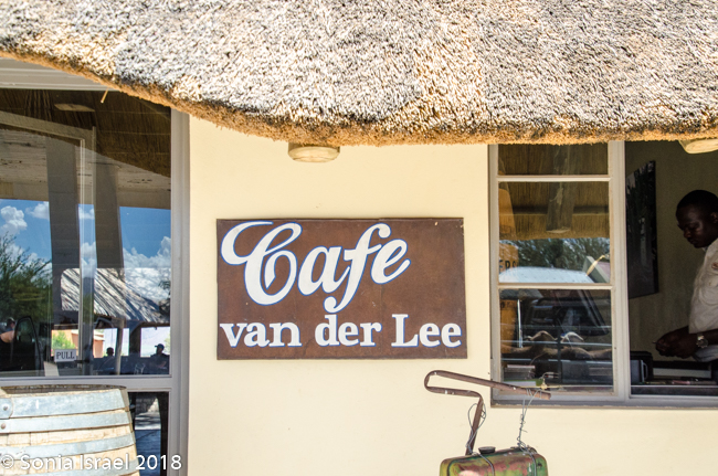
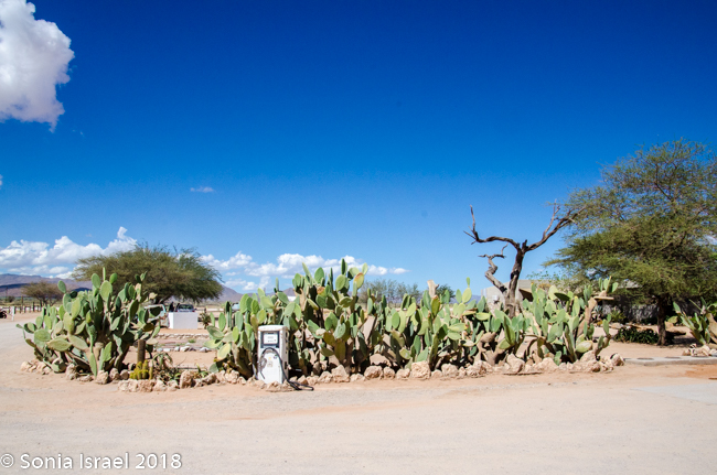
The other place to stop was Solitaire for lunch. Solitaire is a small settlement in the Khomas region, right in the central part of Namibia, which is where we found ourselves. This was pretty much the only place to stop and it reminded me of an old Western town. There was a bakery and a small restaurant, Café Van der Lee, with a menu of about 5 items. There was also a gas station and the toilets were clean. Besides, it was the only place to stop between Sossusvlei and Walvis Bay, which is way up north.
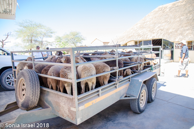
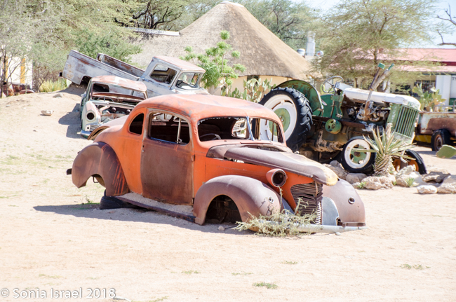
Everything was wood and very open, with birds flying in and out. The gas station had old pumps and old cars on display. Quaint. And you could tell there were still sheep farmers somewhere around here…
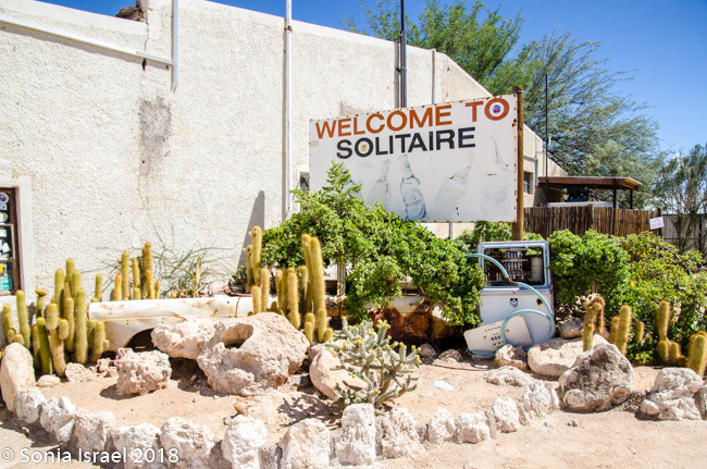
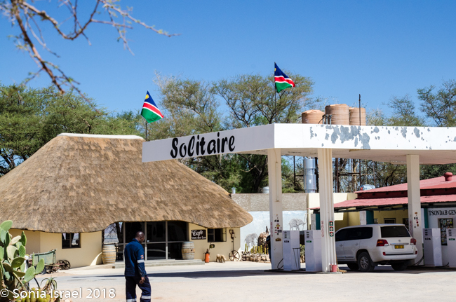
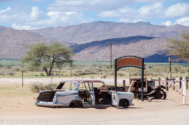
And why is it called Solitaire? There are two reasons. First, because a solitaire is a single set diamond and this was diamond mining country. The second is that solitaire can mean solitude or loneliness, and this place certainly stands all by itself. Combined, these two meanings are supposed to create the definition of being unique or one-of-a-kind and a precious but solitary place.
Condos
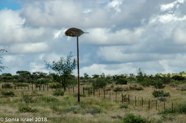
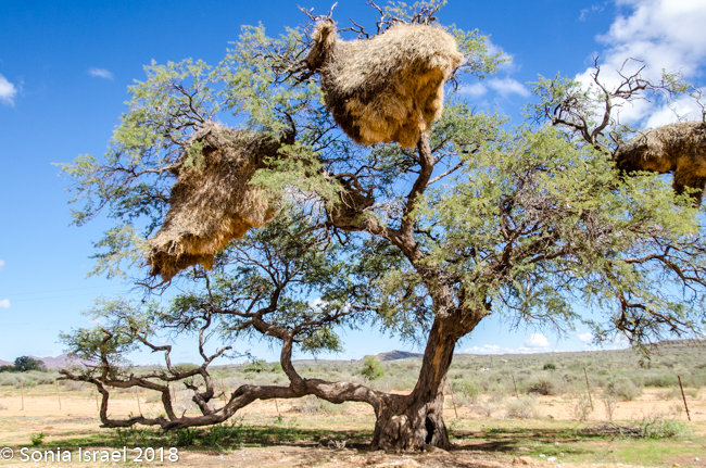
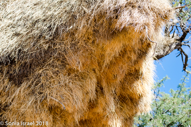
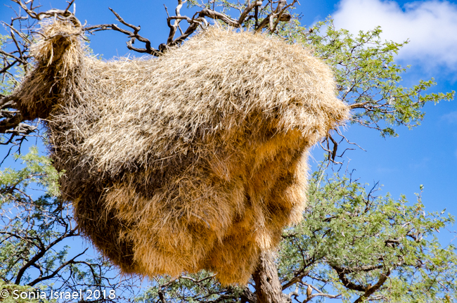
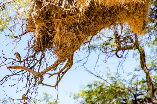
After a quick bite to eat, we hit the road again. Suddenly I saw the strangest tree, or what I thought was a tree. It looked like a tall bark with a large nest on top. Turns out it was an electric pole, with a large nest on top. One after the other. And then I noticed similar large nests in the surrounding trees. Charles pulled over next to one particularly large one and explained that these were nests of the Sociable Weavers, very small birds who build very large nests with up to 100 entrances for about 200 birds. Like a condo unit! The large nest keeps them warm in the winter and keeps the sun off of them in the summer. Each entrance is short and is shaped like a 7 which keeps out their predators.
Blue Wildebeests
We had been on the road for hours, but we were finally getting closer to our home for the next two nights. Charles suddenly pointed out a blue male wildebeest chasing another male wildebeest. That meant there must have been some females 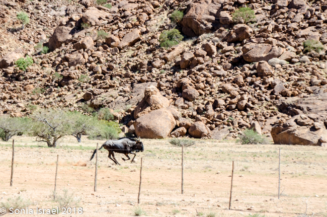 around that he was protecting in his territory. This was one of few animals that we had not seen on our safaris in Botswana and Zambia, so I got very excited. They raced by fairly quickly, going in the opposite direction from us, so we didn’t even have time to stop. But I did get to see them running as fast as they can.
Blue wildebeest, a type of large antelope, are also known as common wildebeests, white-bearded or brindled gnu. The adults’ hues range from a deep slate or bluish gray to light gray or even grayish brown. Both sexes possess a pair of large curved horns.
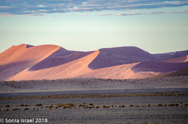
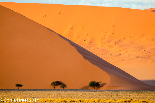
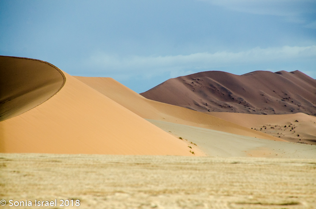
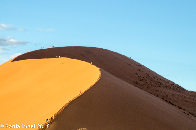
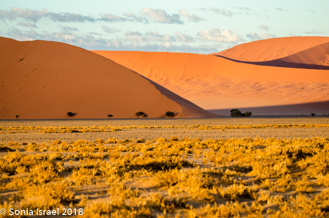
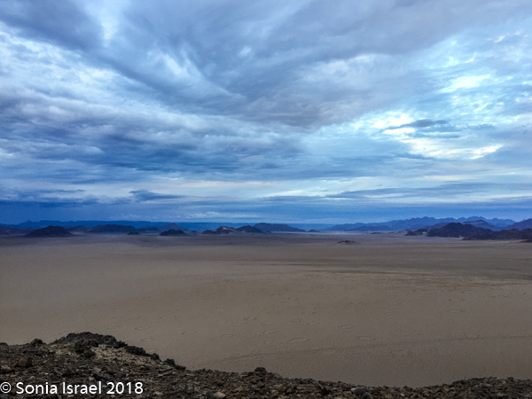
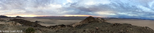
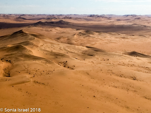
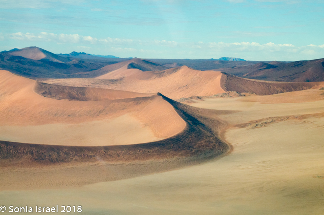
Our first sighting of the dunes
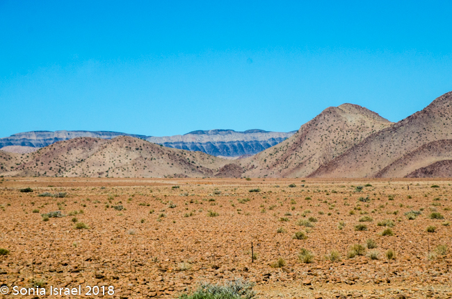
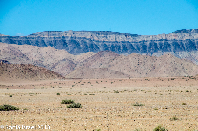
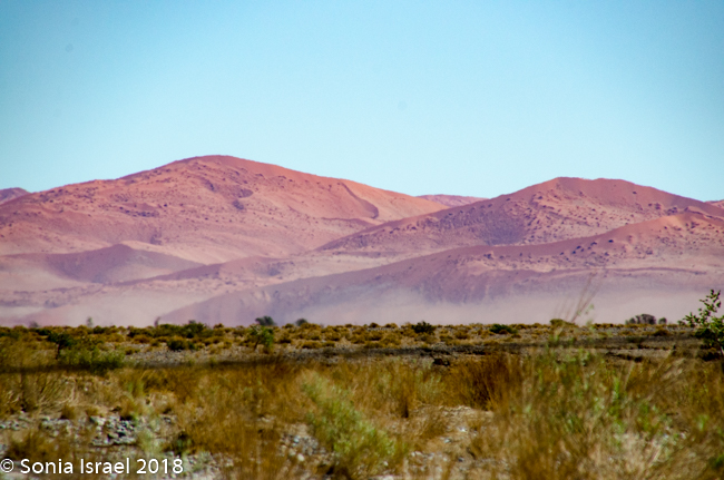
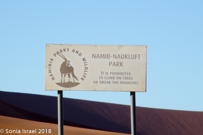
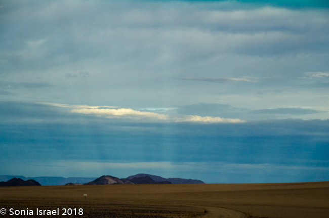
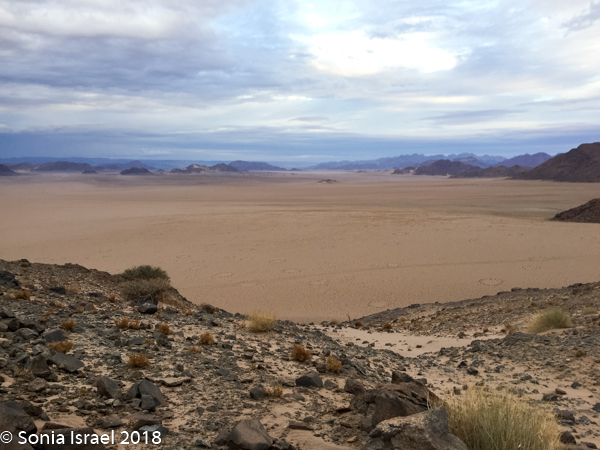
We finally entered the Namib-Naukluft Park. The mountains around us were starting to change color. They looked like painting with stripes of different colors. The road changed from being sandy to being more gravely. Par for the course.
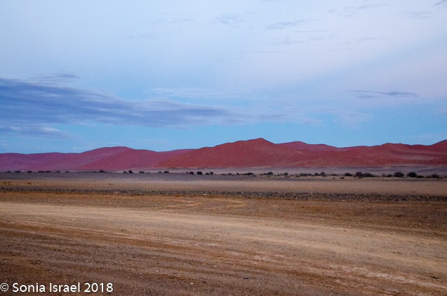
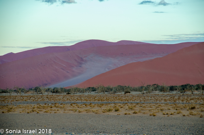
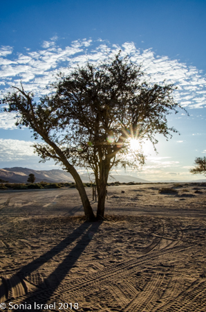
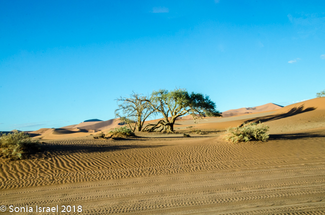
We knew we were getting close as we began seeing the dunes. At first they looked like white sand with little puffs of brown grass. There was a line of trees in front of the them, looking like a green line. And then the dunes turned red. The sky was still a brilliant blue. There were clouds of dust from the car. And it was almost surreal. It was these red dunes that made me want to see Namibia in the first place.
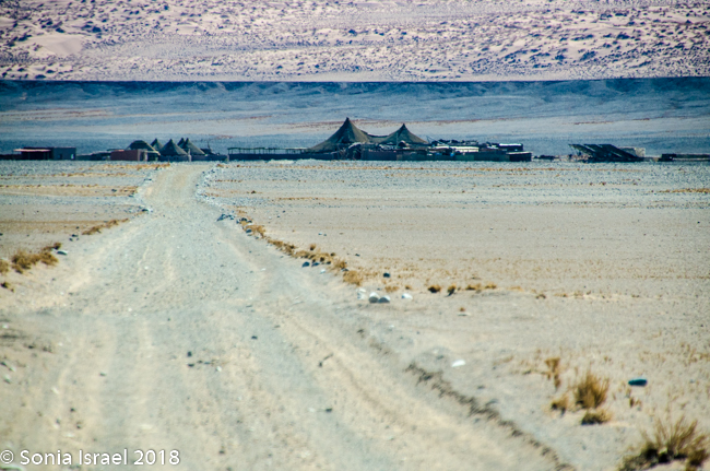
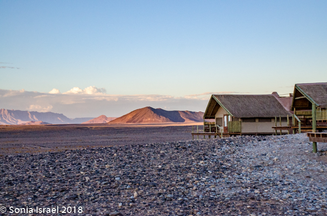
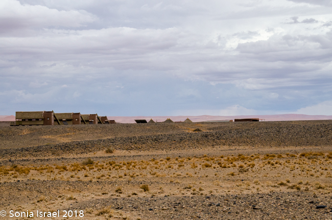
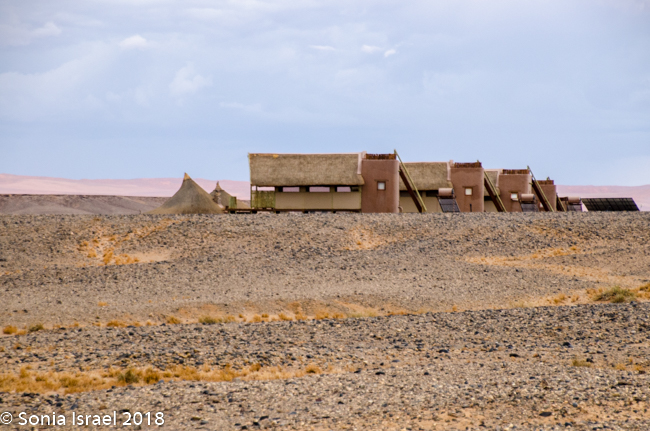
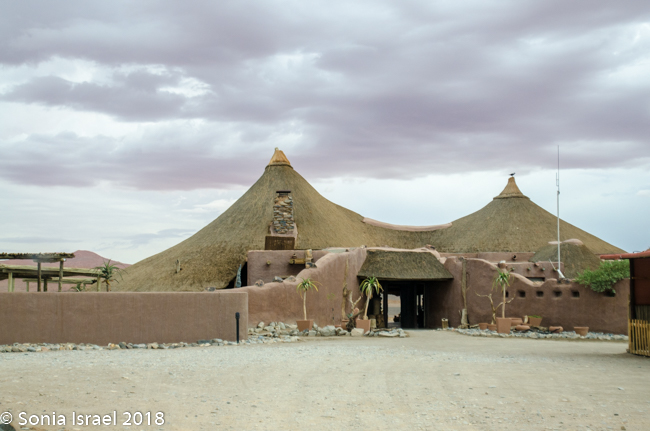
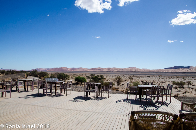
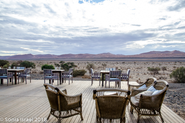
Kulala Desert Lodge
We could see our lodge, the Kulala Desert Lodge. But as close at it looked, it took almost another hour to get there. This is the desert. There are not a lot of roads. And none of the roads seem to be direct, but rather roundabout. So we drove and we drove and eventually we arrived.
-
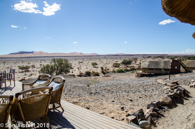
- View from deck
-
- View from deck
-
- Deck overlooking dunes
-
- Our tent
-
- Windows velcro shut
-
- Flashlights for the dark nights
-
- Upper deck for sleeping outside

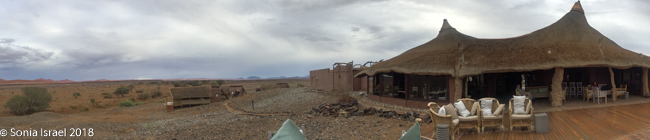
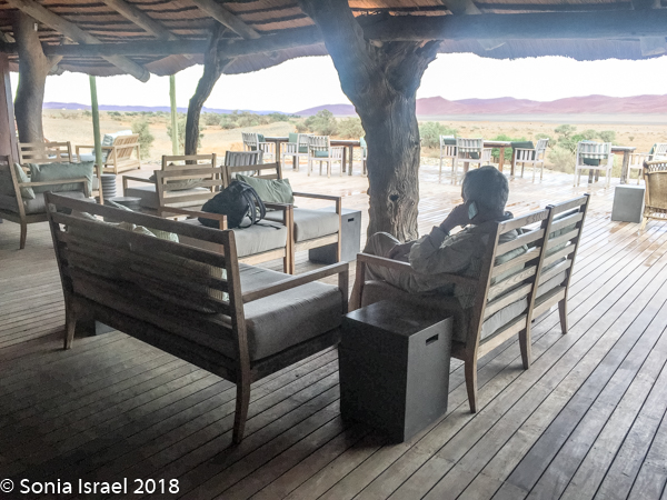
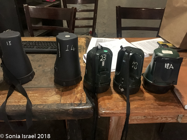
Unlike the lodges in Botswana (please see the Botswana posts), no one greeted us with a song and dance. But they did greet us with a cold towel and a cold drink. We entered the lodge and got the orientation. Here in Namibia you don’t have to worry about walking alone after dark, although a flashlight, or in our case, our head lamps, helped.
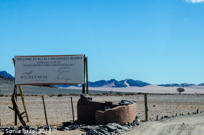
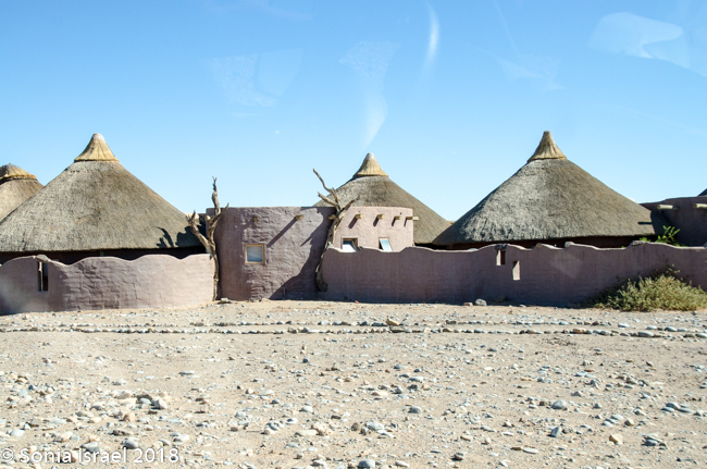
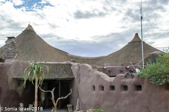
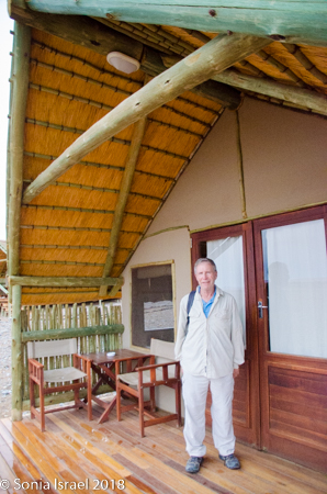
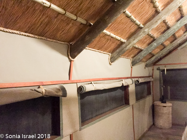
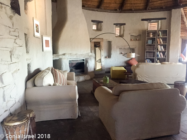
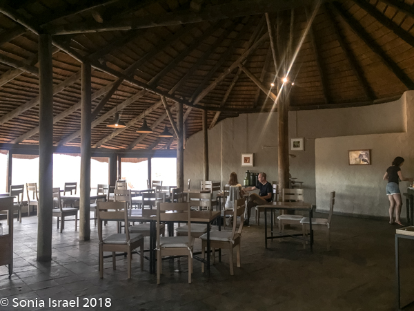
We were shown to our tent, which like the other 22 tents, faced the dunes. The advantage of the Kulala Desert Lodge, which is a Wilderness Safari lodge, is that it is the only lodge located inside the Namib Desert within the private Kulala Wilderness Reserve. Kulala means “to sleep” in Swahili. Kulala also means canvas tent, and that is exactly what the accommodations were. A large canvas tent, with screened windows which had a canvas cover you could Velcro in place, a screened door, a bathroom and veranda, and stairs leading to a wooden platform where you could sleep at night, under a million stars. Unfortunately, the weather did not cooperate for outdoor sleeping. There was a large living-room type lounge, a bar and both indoor and outdoor eating, depending on the weather. But both locations had spectacular views overlooking the desert vista. There was also a swimming pool, but the water was freezing.
This area was once full of wildlife. But a German farmer brought in sheep from Iran and it was so profitable, that all the farmers started doing it. But the sheep ate all the grass and there wasn’t then enough for the local wildlife. In addition, the farmers killed the predators. So slowly the entire area was destroyed. There are still a few sheep farms, but not as many as before. And the large number of wildlife never returned.
As I wasn’t feeling well, I gave up on the sundowner for that night (driving to the top of a mountain to sip wine and watch the sun set), and instead went to bed. The chef made me some soup which Charles brought to me room. And I crashed, needing a good night’s sleep to recover. That and Imodium. Never travel without it!
April 14, 2018
Ballooning over Sossusvlei – or not!
The next morning, I was feeling better. We had set the alarm for 5:00am as we were scheduled to take a balloon ride at sunrise over the Sossusvlei dunes. Unfortunately, when we got to the lounge for coffee, we found out that there had been lightening so the balloon ride had been canceled. So instead, Charles drove us to the dunes so we could finally take off our shoes and feel the sand between our toes, something we had planned to do the next day.
Sossusvlei
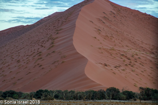
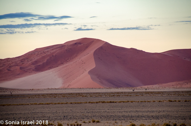
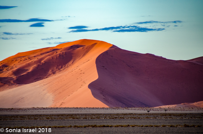
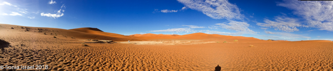
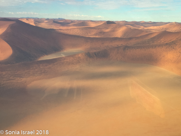
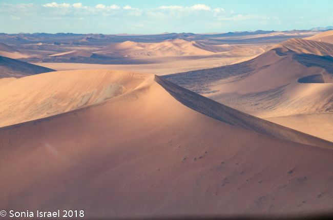
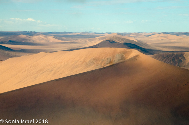
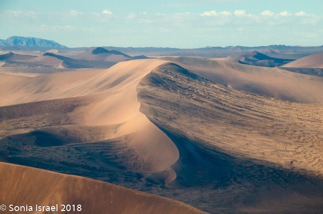
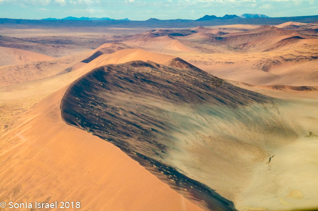
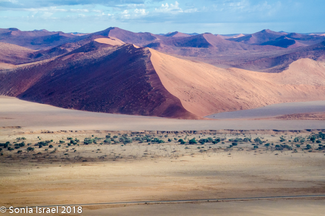
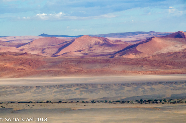
Sossusvlei is located in the Namib-Naukluft National Park. The whole Sossusvlei region is made of a salt and clay pan famous for its sand dunes, which range in color from deep orange to bright pink, from apricot to purple. They are some of the largest in the world, occasionally exceeding 1,000 feet. The red and orange and pink come from the oxidation of the sand’s high iron content.
The advantage of staying right in the park, so close to the dunes, is that we could be there just as they opened at sunrise. There is one small lodge inside the dunes that many photographers reserve so they could actually watch the sunrise over the dunes. But we took the private Kulala road right to the gate of the reserve, where we watched the sunrise while waiting for the gate to be unlocked. There was a bright orange strip as the sun rose over the horizon, the clouds in the sky turned from white to black to dark blue to pink. It was beautiful. The light reflected on the dunes making them look almost striped in three shades of pink, light pink, dark pink and purple. I had never seen anything like it.
The guard at the gate house came over right after 7:00am, opened the gate and off we went. We saw oryx drinking out of a puddle and a jackal, running as fast as he could. The reserve is also known for ostrich, springbok, gemsbok, spotted hyaena and occasionally a brown hyaena, as well as the black-backed jackel (which we saw), the cape fox and birds galore.
-
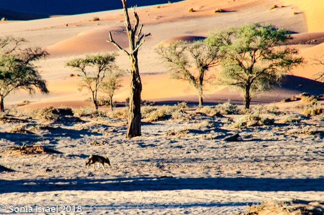
- Black backed jackel
-
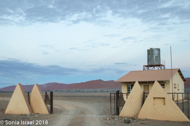
- Private gate
-
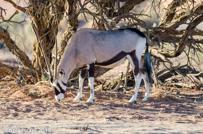
- Oryx
-
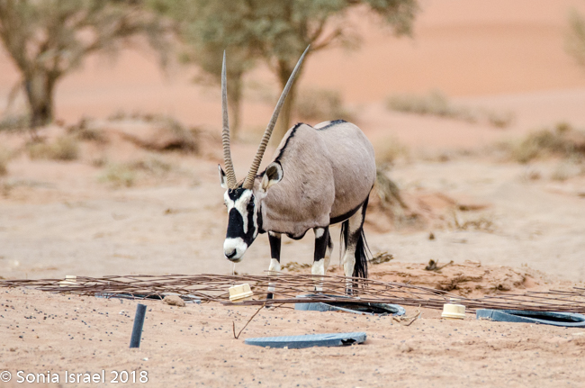
- Oryx
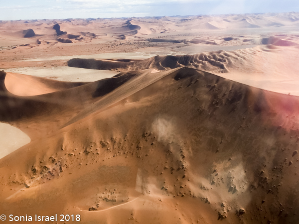
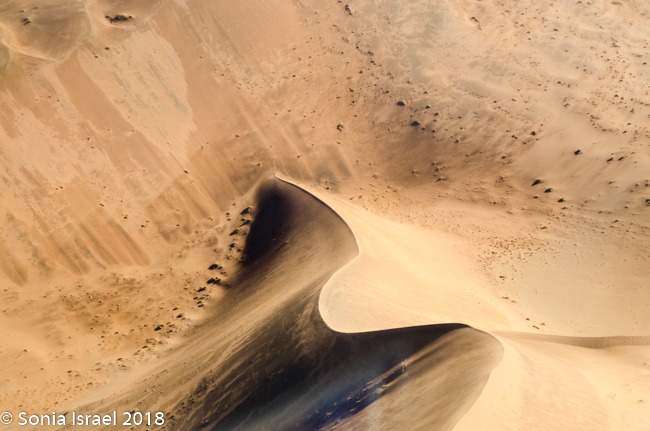
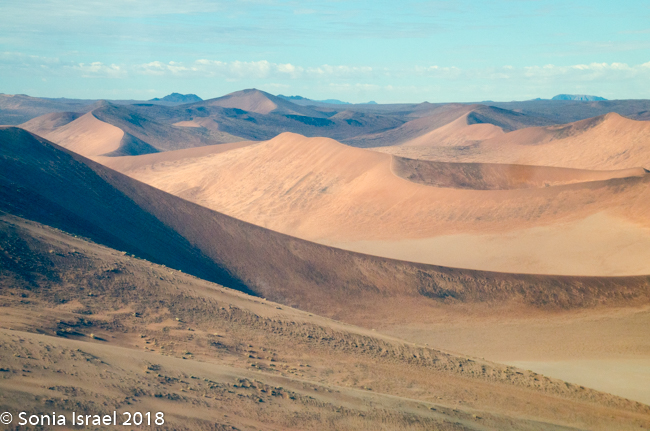
We stopped along the road to admire the dunes and to photograph the different angles and shadows. And this was all still close to the entrance. Charles explained how there are three different types of dunes, and just standing along the side of the road, he pointed out each one. There were the linear dunes which had straight or slightly sinuous sand ridges, which are usually longer than they are wide, thus called “linear.” Sometimes linear dunes form sets of parallel ridges separated by miles of sand or gravel, while others merge to form y-shaped compound dunes. The second type of dune Charles pointed out was the star dune. These are radially symmetrical dunes which are shaped like a pyramid and have three or more “arms” which radiate from the high center of the mound, thus resembling a star. The third, and most common, was the barchan, or crescent dune, is shaped, as the name implies, like a crescent which is usually wider than it is longer.
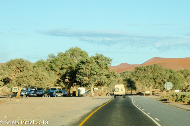
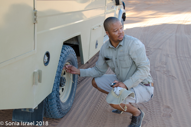
But I was antsy and wanted to get into the heart of the park. We passed the parking lot, where most cars should stop and park and then shuttle in. The ridiculous part was the number of cars that thought they could drive all the way in. We were in a Toyota Land Cruiser with an experienced driver. We stopped just at the other side of the parking lot so Charles could reduce the amount of air in the tires. Turns out that is how you drive in deep sand. But we were surrounded by all these cars that had gotten stuck in the sand. One by one they came over to ask Charles what to do. Some of the guides helped them push their cars out of the ruts, where they then left them to shuttle in. It was hard for me to believe that people were self-driving in an area where they know nothing about how to survive. That is just one more reason that I like having a guide/driver.
-
- deflating tires

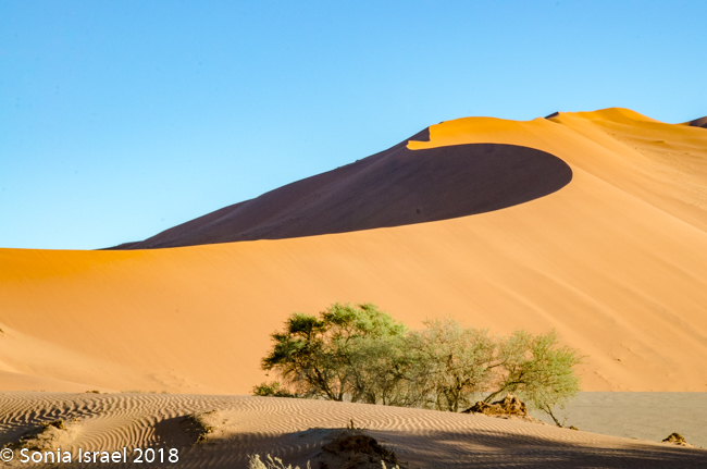
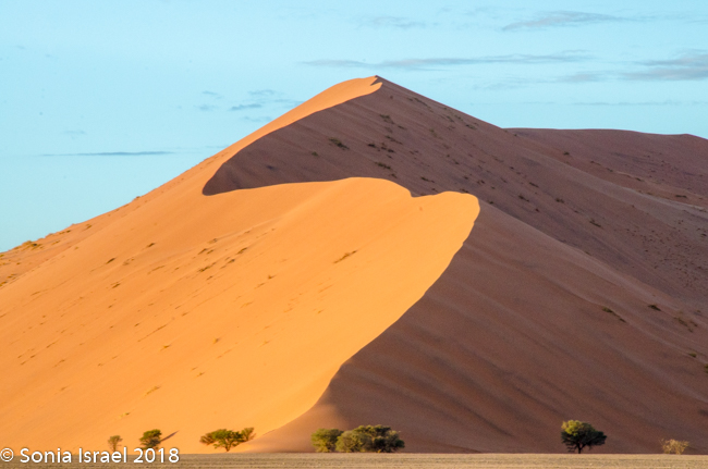
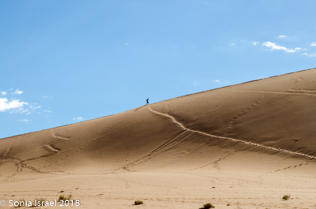
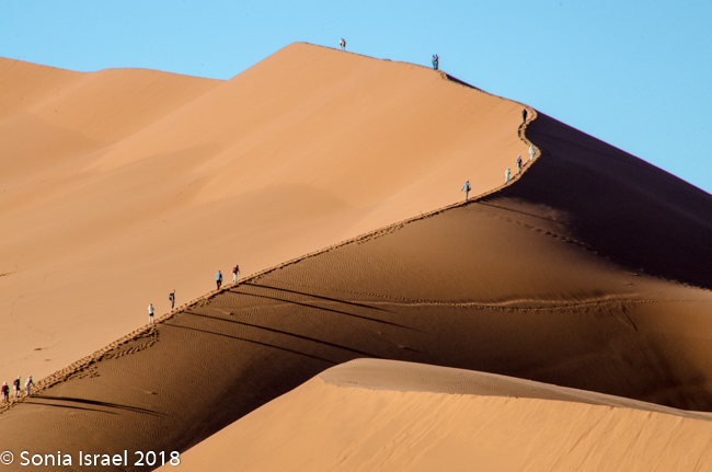
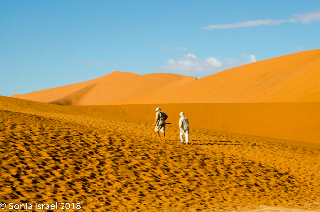
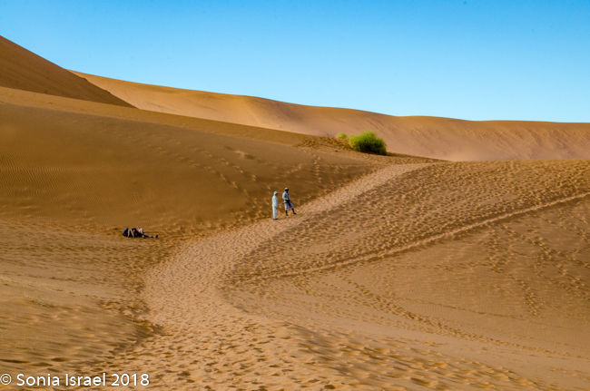
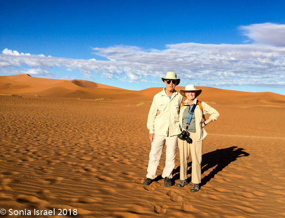
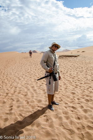
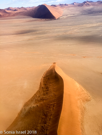
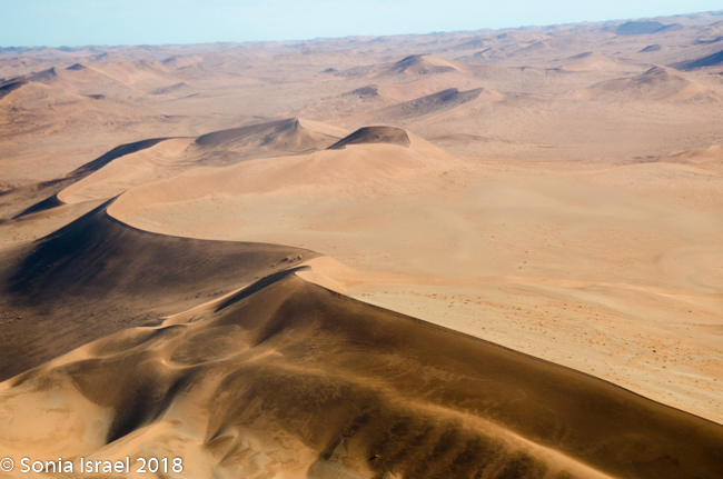
Once our tires were nice and low, we slowly drove the rest of the way to park near Big Daddy. Big Daddy is the tallest dune in Sossusvlei (although the biggest dune in the Namib Desert is called simply Dune 7), and it is the dune that people come here to climb. We watched person after person hike up the ridge trying to reach the top. Their bodies were silhouetted against the sky and then, when they reached the top, they either hiked or slid back down. That seemed to be the thing to do, but not for us.
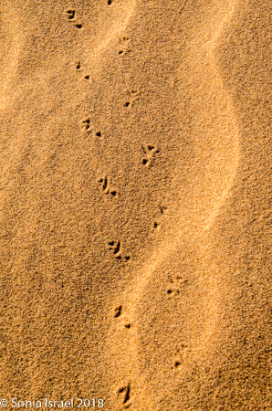
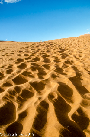
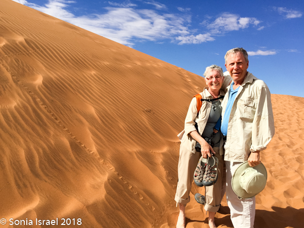
We started walking on the sand, and Charles would stop to show us snake tracks and scorpion tracks. Nevertheless, I took off my shoes to feel that fine sand between my toes.
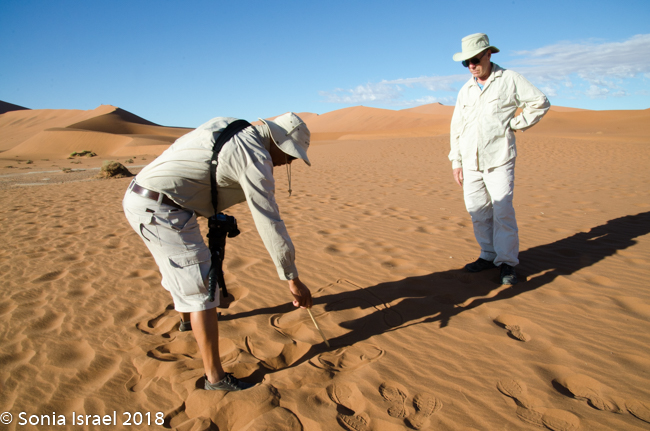
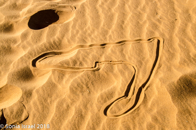
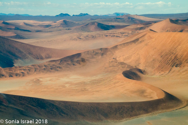
We walked a short way and Charles stopped us again, drew a map of Namibia in the sand, and gave us a lesson on the geography. Sossusvlei, which means “a gathering place for water” (sossus) combined with Afrikaans for “a shallow lake” (vlei), was created by the wind from the coast carrying all the sand. Where does this “shallow lake” come from? It comes from the dense ocean fog created when the dry desert air forces the humid ocean air down. There is one bug that is particularly adapted to this climate. The Namib Desert Beetle waits for the fog to settle on its back, and then drip down into his mouth. Amazing!
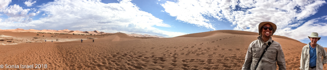
We walked some more and more and more. The dunes were spectacular as they towered over us. The sand was like silk between my feet. It was red, yet pinkish all at the same time. As the light changed, the color changed. It went from red to pink to gold. Some of the dunes had small, light brown patches. It was as if the dunes had a fire within them.
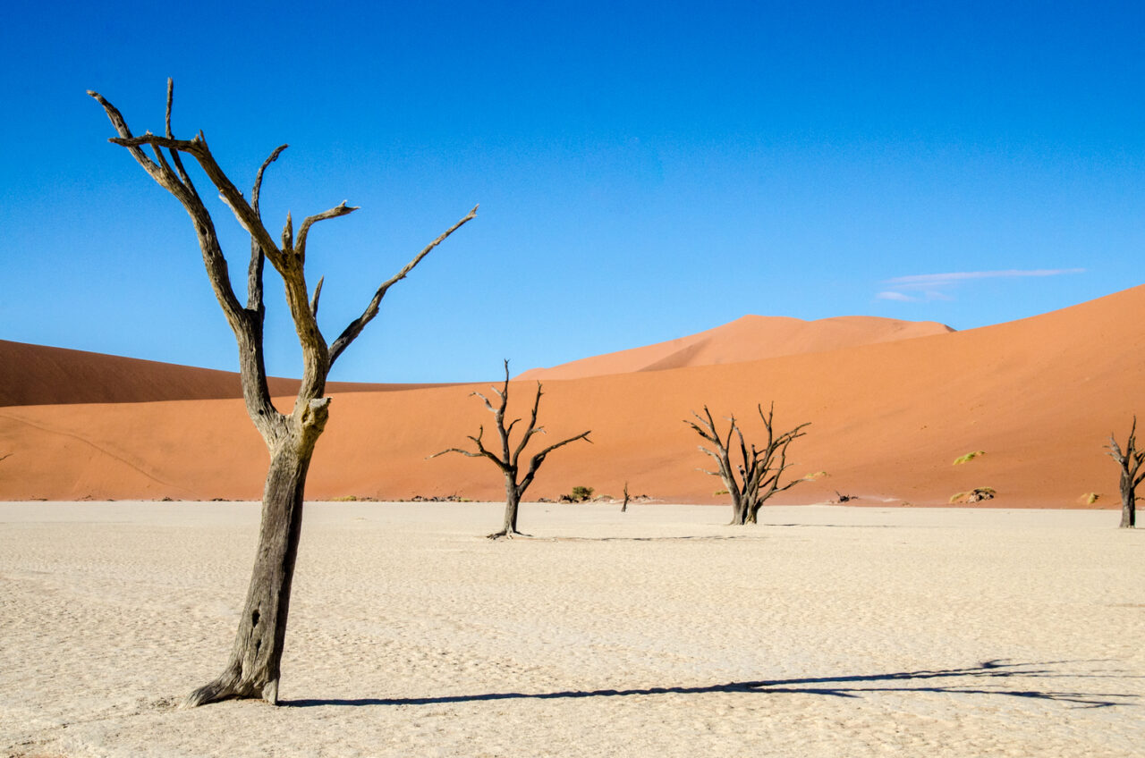
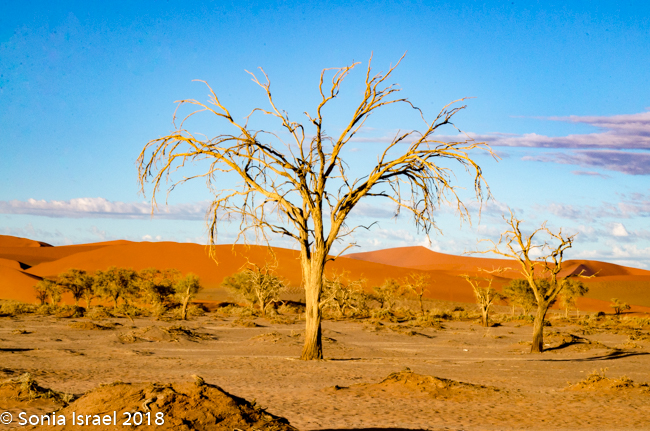
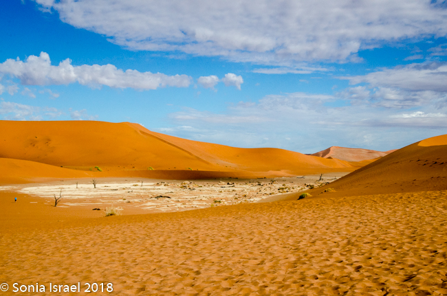
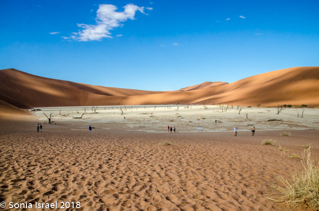
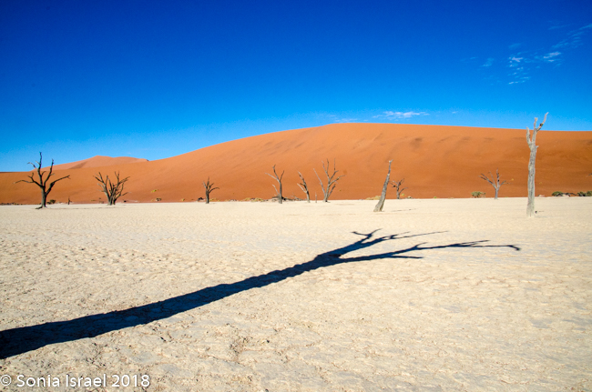
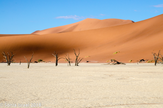
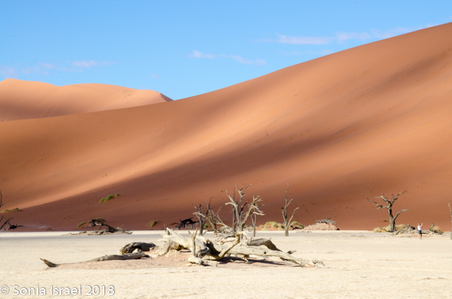
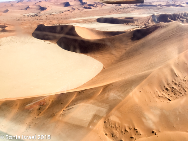
Dead Vlei
Our destination was Dead Vlei. This is a white clay area in the middle of Sossusvlei. Dead Vlei means “dead marsh” (from dead in English and marsh (vlei) in Afrikaans). As we crested over the dune, down below was what looked like a white, dry lake covered with dead trees. Or an ice-skating rink. It was so white against the apricot-orange sand. The area was formed after a heavy rain which caused the Tsauchab river to flood, thus creating temporary shallow pools. Camel thorn trees (also called giraffe tree or the acacia tree) began to grow in all that water. But when the climate changed and drought hit, the sand dunes encroached on the clay area, blocking the river. The intense sun dried the lake and the trees died. All this happened 600-700 years ago.
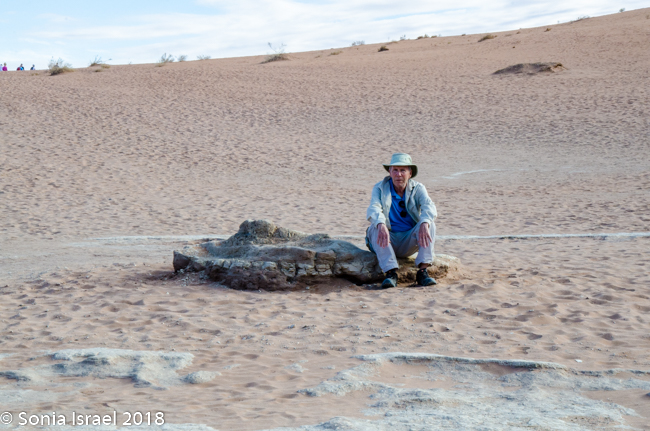
-
- Charles
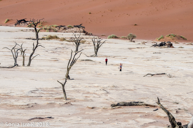
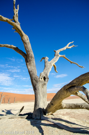
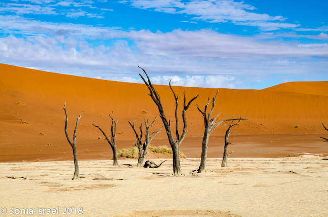
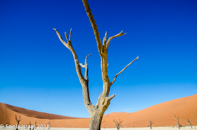
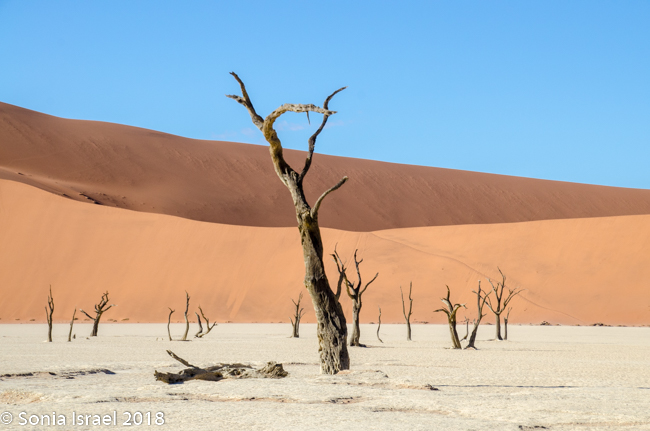
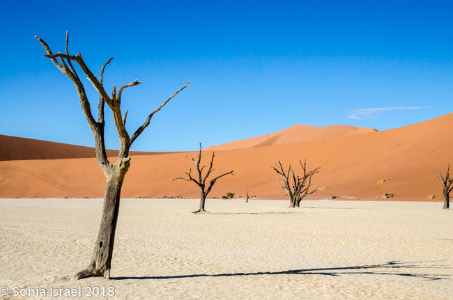

I slowly walked towards it. It was what I imagine the moon might look like. Or Mars. There were just a few other people, all of us just walking around looking at the dead white trees against the red dunes and below the deep blue sky. And then there were the shadows. It was ethereal. Unreal. It was like the trees were ghosts, standing there in weird shapes, with the branches like arms reaching up to the sky. There is no other way to describe the unbelievable beauty of that place. It made me so, so happy to be in Namibia at Sossusvlei.
A few days later, my iPhone made a video. It includes many of the photos from above, but I think it gives a feel for what it felt like to be there.
The Cape Sparrow
On the way out, as we were climbing into the car, I saw a cape sparrow in the tree. It was small, about 5 inches with grey and brown and red feathers, almost in stripes. 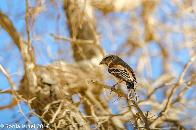 And it was singing a song for us. I imagined it was a good-bye song as we were leaving this beautiful place.
Sand, sand, sand. Everywhere!
We got back to the lodge and were relaxing in the lounge when suddenly the beautiful weather changed. The sun hid behind the clouds, the wind picked up and the sand started swirling all around us. It was a sand storm. Fine sand was everywhere!!!!! In our sheets. In our clothes. In our ears. In our eyes. In the cameras. In the computer. Everywhere
Fairy Circles
When things cleared up, we left for our sundowner. On the way we passed a series 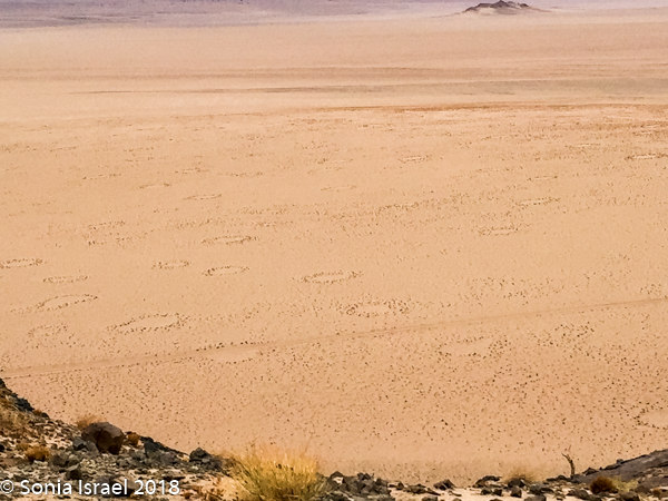 of circles in the sand. These were the fairly circles of Namibia. They are circular patches of land barren of plants. They vary between 7 and 49 ft in diameter and are often encircled by a ring of stimulated growth of grass. And no one knows for sure what they are.
One theory that has been tested is that they are a result of plants’ competition for scarce water with the plants “organizing” themselves to maximize access to scarce resources. The theory continues that the circular barren patches capture water which then flows to the outer edges of the ring.
But a second, more popular theory is that the sand termite is responsible. This theory is being tested, but some say you can find the circles in areas where there are no termites.
My personal favorites are the oral myths of the Himba and San Men (once called Bushmen) who ascribe spiritual and magical powers to them. They believe that these barren patches are the footprints of the gods.
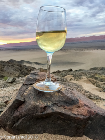
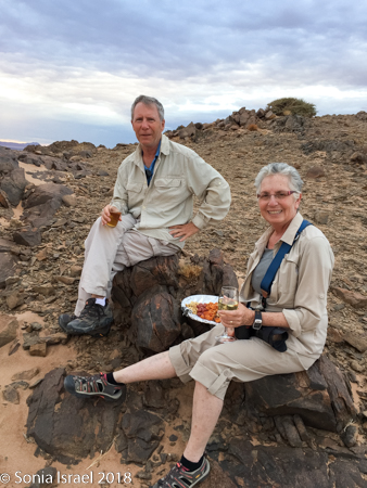
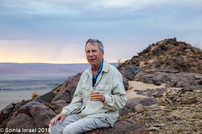
Sundowner
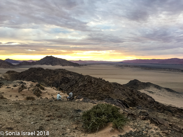
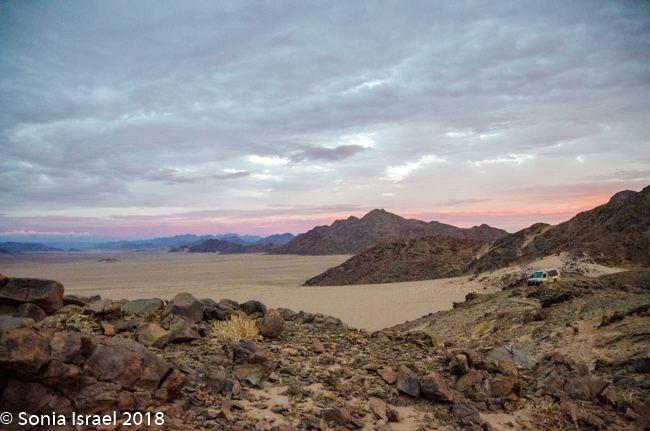
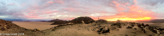
Charles drove up a mountain. Literally. No real road. Just 4-wheel drive pushing us and the car up a mountain. We stopped close to the top, got out and walked a bit higher. Charles took out a platter of cheese, nuts and fruit. I had my wine and Andy his beer. But the most important part was that from there we had a 360 degree view of the valley. The large expanse of sand. The dunes. And just as the sun had turned the dunes into fire in the morning, it now turned the sky into flames.

Dinner and a show
We came back to find dinner set on the outside patio. Candles were on the tables. We sat down just as it started to rain. Everyone grabbed their plates and glasses and we retreated inside (which mean there is a roof, but no walls so we c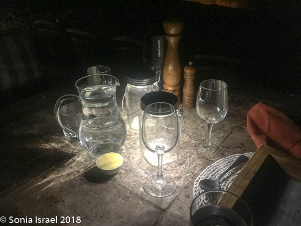 ould still enjoy the fresh air). And as it rained, everything changed colors. The air smelled so fresh, like the smell of the earth.
Suddenly we heard drumming and singing and the entire staff danced in. They entertained us from songs and dances from several different tribes. Although we couldn’t understand the words, we certainly got the gist.
A fitting ending to an amazing day.
April 15, 2018
Flying over Namibia
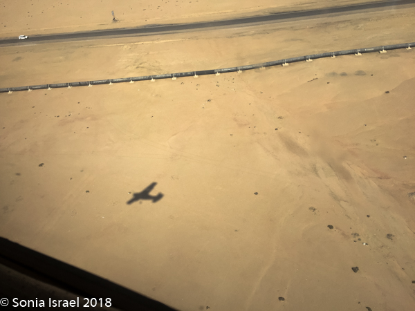
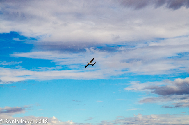
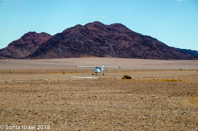
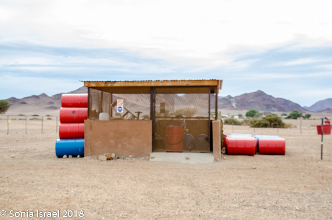
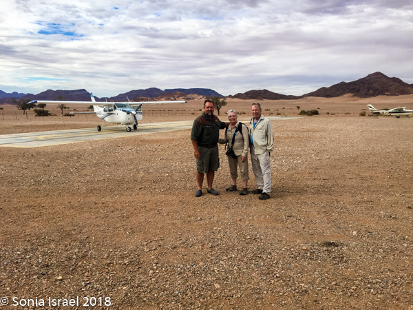
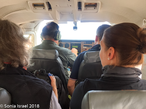
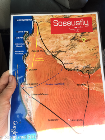
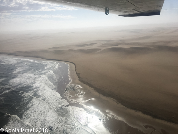
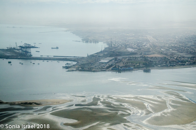
This morning the balloon ride was canceled again. Charles decided that instead of subjecting us to a 5-6 hour drive to Swakopmund, especially since it was not a very interesting road, he would arrange for us to take a scenic flight from Sossusvlei to Swakopmund with the company Sossusfly. He drove us to the private Wilderness Safari airstrip where we met up with Katherine, a Swiss woman traveling alone. The airstrip is the only one in this area, but like in most of the bush, it was just a sand strip with a shack holding the extra fuel. The tiny 5-seater Cessna 200 (including the co-pilot seat) landed and we noticed there were two passengers on board all ready as some make a round-trip. The pilot came out to shake our hands and introduce himself. He then looked us over deciding who the photographers were and where we should each sit. At first he suggested I sit in the second row, but then he realized that Katherine was very tall with very long legs. So Andy and I were delegated to the third and last row where we squeezed in.
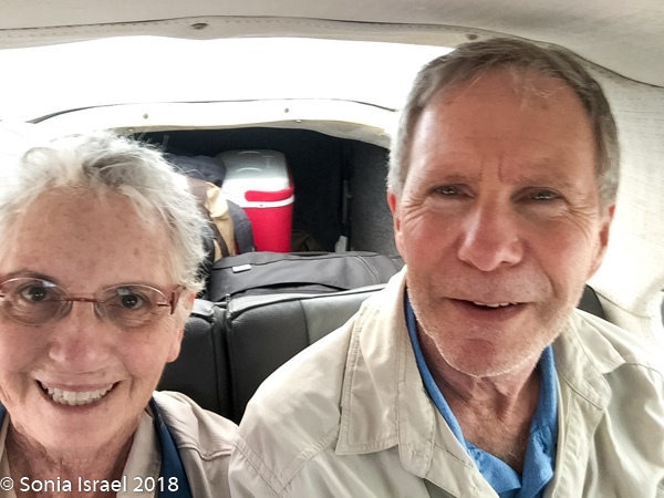
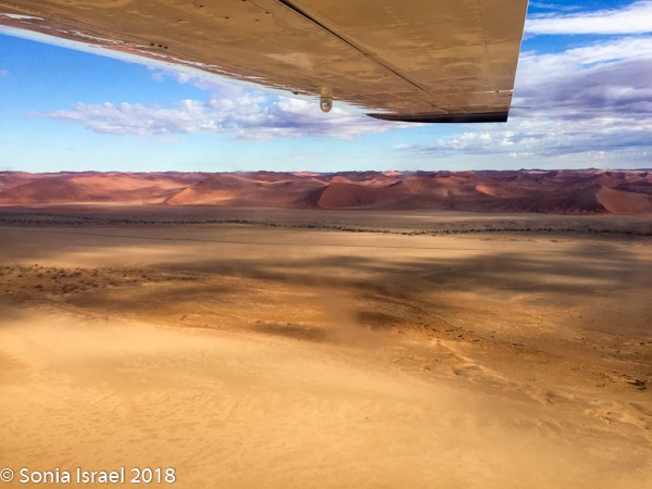
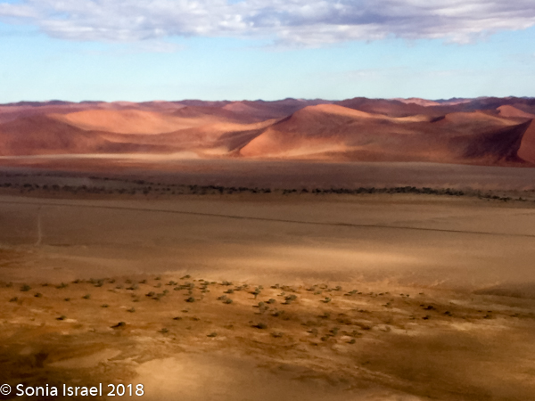
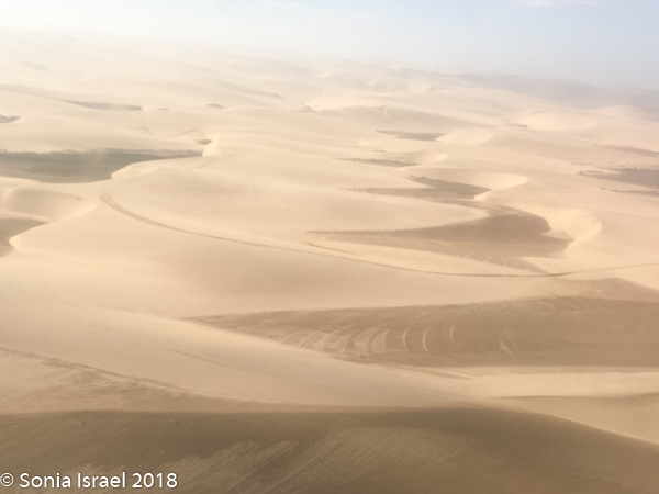
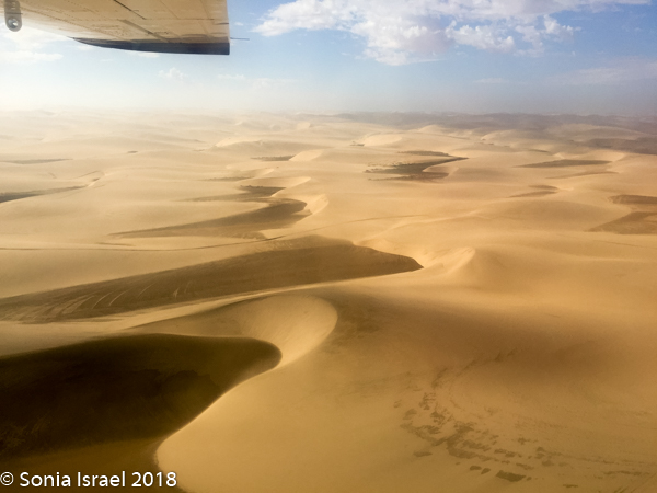
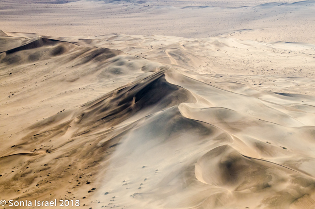
I was excited about seeing the dunes from above. We took off and I started taking pictures. Except my camera had great difficulty focusing. The window was so scratched that the camera could hardly see past it. I was not a happy camper. I ended up using my phone camera more than my Nikon. And many of those pictures had to be deleted too.
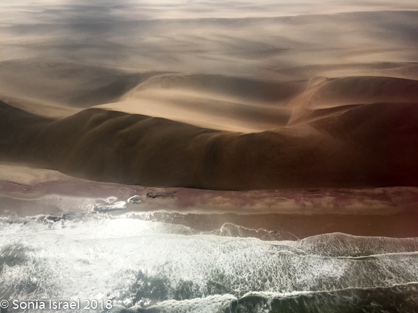
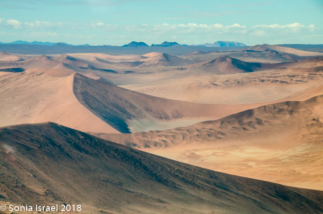
The views however were spectacular. We flew over the dunes which, from the sky, ranged in color from pale apricot to brick orange to deep red and then slowly turned white as we headed north. The shapes created by the wind and the shadows were amazing, creating all sorts of designs. The sharp edges at the top of the dunes looked like they were drawn with a ruler.
We flew over the restricted diamond area and the old deserted diamond mines.
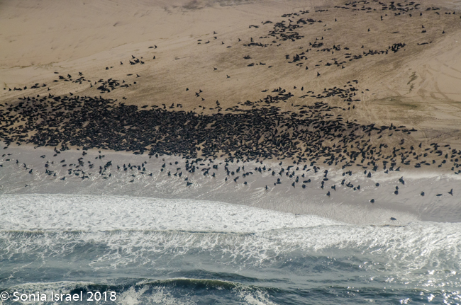
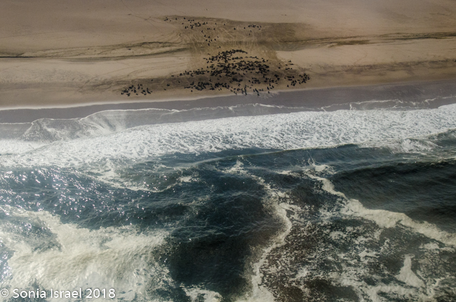
We flew over cape seal colonies which turned the coast black as there were so many hundreds of them.
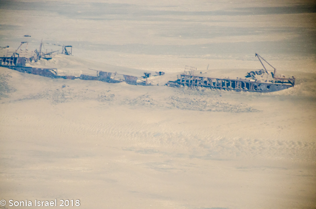
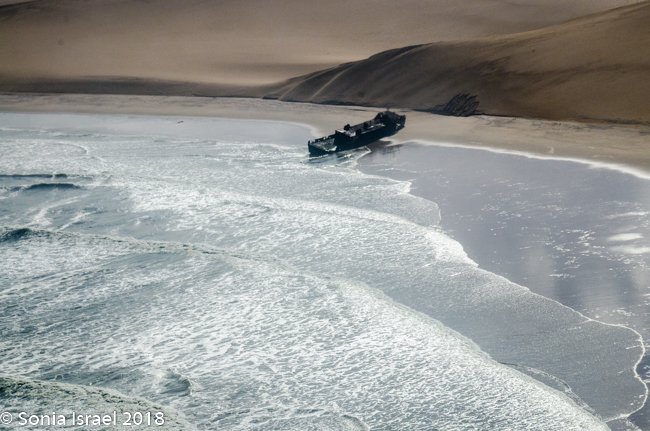
We flew over the Eduard Bohlen and Shawnee shipwrecks along the Skeleton Coast. There are several thousand shipwrecked vessels along this coastline, as well as sun- faded whale bones, and at one time, human bones. The areas rough seas, roaring winds and strong ocean currents are the main reason for these wrecks. But what makes these special is that, although the were gounded in the water, the water line has receded, and the desert has encroached and now it looks like the remains of the ships were stranded in the middle of the desert. (Please see the post about the Skeleton Coast for more info on this).
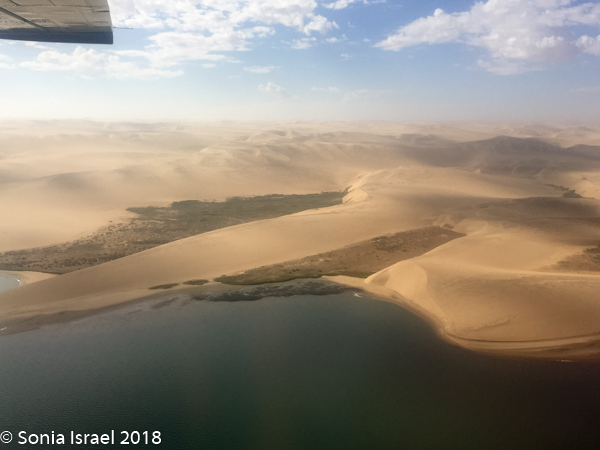
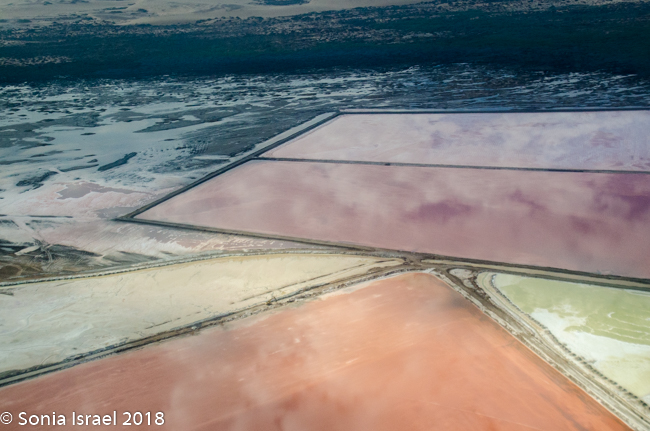
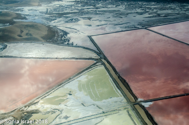
We flew over the salt mines just south of Walvis Bay with their red, and pink and green hues. These salt mines supply about 90% of Africa’s salt. It is the largest of its kind in the world. There are vast areas that were leveled and surrounded by low dikes. Sea water is pumped in and left to evaporate in the hot Namibian sun. The salt then crystalizes forming mounds which look like snow. It is also a rich feeding ground for shrimp and larval fish, thus the colors. And, together with the Walvis Bay Estuary (more on this in the Swakopmund post), it is one of the most important wetlands in Africa. The nutrients in the ponds sustain flamingos and as many as 60 other species of birds, with up to as many as 120,000 viewed there at one time. As a supplementary operation to salt production, oysters are also produced here.
We passed what looked like a green oasis in the midst of the desert. It was the Langstrand resort (famous for being an area for the rich , including Angelina Jolie).
After flying for about 1.5 hours, we landed in Swakopmund. But that is another story.